Monday, July 11, 2011

A 3-D View of the Paine Massif viewed from the South


This map gives you a good 3-D idea of how the Paine Massif appears looking from the south.

Where is Torres del Paine National Park?


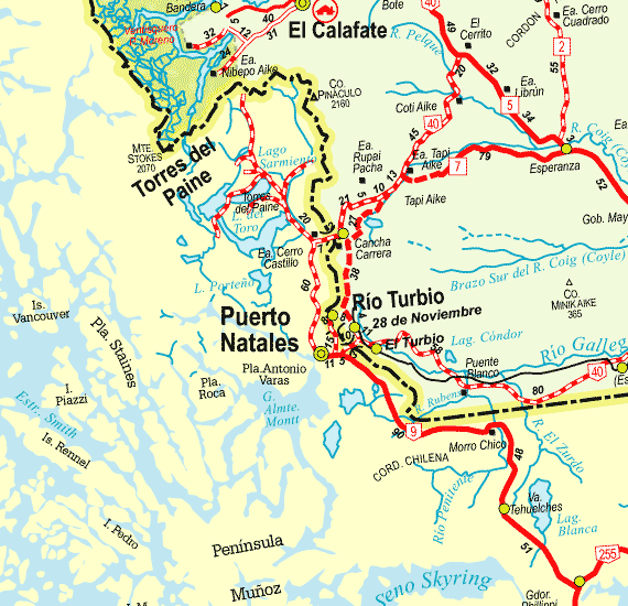
These two maps give you an idea where the Torres del Paine is located. It's a very remote location at the southern tip of South America. On the blue and green map it's the white area outlined as a national park just to the north and east of the portal town of Puerto Natales. The area is white on the map because Torres del Paine lies at the southern end of the Campo de Hielo Sur. This is one of the largest expanses of unbroken ice and glaciers in the world.

Sunday, July 10, 2011

Hosteria Pehoe, Lago Pehoe and the Cuernos del Paine

This photograph was taken from Hosteria Pehoe which sits on a small  island in Lago Pehoe. The mountains in the background are the Cuernos del Paine. Torres del Paine National Park in Chilean Patagonia is one of the most beautiful places my wife and I have ever seen... A picture's worth a thousand words!